Technology in Animals Explained: How Tech Is Changing Animal Care, Conservation, and Farming
Key takeaway: Technology in animals means using GPS collars, AI camera traps, drones, acoustic sensors, and smart pet wearables to track, protect, and care for animals. It helps rangers stop poachers, vets catch illness early, and farmers monitor herds — but it works best alongside people on the ground, not instead of them.
Technology in animals is no longer a futuristic idea. From an elephant wearing a GPS collar in Africa to a dog wearing a health-tracking collar in a city apartment, sensors and software now follow animals wherever they live. The goal is the same in every case: learn more about animals without disturbing them, and act faster when something goes wrong.
What technology in animals actually covers
The field splits into three main areas. Wildlife conservation uses collars, camera traps, drones, and sensor networks to protect endangered species and study their behaviour. Pet care uses smart collars and health monitors to track activity, sleep, and vital signs. Farming uses similar sensors to watch over livestock health, grazing, and breeding. The hardware often overlaps — a GPS tracker on a wolf and a GPS tracker on a dog are cousins, not strangers.
GPS collars and bio-loggers track animals in real time
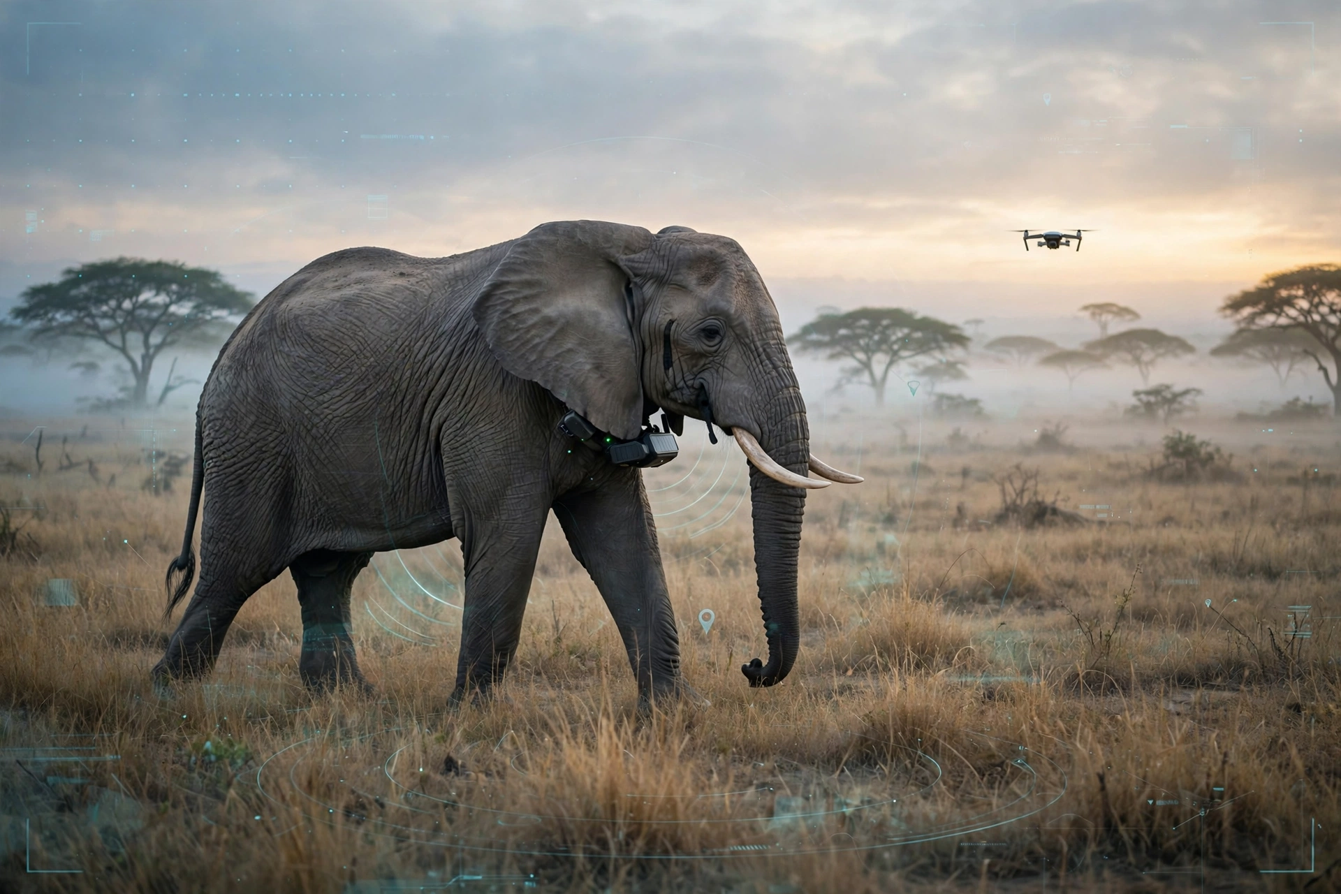
GPS-equipped collars are the workhorse of wildlife research. They record an animal’s location and, increasingly, its heart rate, body temperature, and activity levels. Machine-learning models then analyse that data to reveal behaviour patterns, migration routes, and early signs of distress. In aquatic environments, smart tags on marine animals provide similar insight into diving patterns and habitat use, while drones with thermal imaging can spot animals hidden in dense vegetation and assess their body condition.
All of this data flows into platforms such as EarthRanger, a real-time tracking and visualisation tool developed by Vulcan Inc. that pulls together radio collars, cameras, GPS, and satellite imagery on one map. A Global Environment Facility-supported project has deployed EarthRanger in protected areas in Botswana, the Republic of Congo, and Mozambique, helping rangers see animals, patrol teams, and threats on the same screen and deploy resources faster. Source: Global Environment Facility
AI camera traps identify animals — and intruders
Camera traps have watched forest trails for decades, but AI changed what happens to the photos. Modern systems analyse live footage from camera traps to detect unusual changes in light, sound, and movement, flagging potential threats for field staff. AI-powered tools such as wpsWatch sort through thousands of images so rangers do not have to, and acoustic sensors listen for gunshots, chainsaws, and distress calls across areas too large to patrol on foot. Source: ZME Science
The same computer-vision techniques can identify individual animals by their natural markings — the wrinkle patterns on an elephant’s face, the whisker spots on a cheetah, the stripes on a zebra — building population databases that are more accurate than ground surveys alone.
Drones give conservation teams eyes in the sky
Drones cover terrain that is too vast, dangerous, or sensitive for people on foot. They count herds, map habitat, follow migrations, and deter poachers. Thermal cameras let them work at night, when poachers are most active: a drone can spot a warm human shape moving across a cold plain in real time, and machine learning separates a person from an elephant or a tree by their heat signature, so rangers can be dispatched to exact coordinates before a poacher reaches the animals. Source: AI Plus Info
Drones also count wildlife that ground teams cannot see. Deep-learning models trained on nest photos can find orangutan nests in Sabah and Sumatra, thermal cameras pick out koalas in eucalyptus crowns that human observers miss, and drone surveys of mass-nesting beaches produce far more reliable population estimates for giant Amazon river turtles than scramble counts from the ground. Source: Branta Media
Smart collars bring the same tech home to pets
The pet world has adopted the same ideas at a smaller scale. Smart collars now track location, activity, sleep, and vital signs, and AI turns that data into plain-language health summaries for owners.
Tractive’s 2026 lineup illustrates the trend: the DOG 6 XL (MSRP $89) adds scratch monitoring that flags changes which may signal allergies, skin irritation, pain, or stress, while the CAT 6 Mini ($79) is the company’s first collar-integrated GPS and health device built for feline physiology, tracking resting heart rate and respiratory rate against feline baselines. Source: BusinessWire / Tractive Fi’s Mini tracker, at just 16 grams, adds GPS and LTE-M location tracking with up to three weeks of battery life, and AI-powered health tracking is planned to follow. Source: Notebookcheck
For owners, the practical value is early warning: a drop in activity, a change in sleep, or a rising resting heart rate can surface days before a pet shows obvious symptoms, giving a vet a baseline of data instead of a guess.
Technology in animals at a glance
| Technology | Main use | Where it helps most |
|---|---|---|
| GPS collars and bio-loggers | Location, heart rate, temperature, activity | Wildlife research, livestock, pets |
| AI camera traps | Species identification, intruder alerts | Anti-poaching, population counts |
| Drones with thermal cameras | Aerial surveys, night patrols | Anti-poaching, herd counting |
| Acoustic sensors | Gunshots, chainsaws, animal calls | Forest protection, marine monitoring |
| Smart pet collars | Activity, sleep, vital signs, GPS | Early illness detection in dogs and cats |
| Farm sensors | Herd health, grazing, breeding cycles | Livestock welfare and productivity |
Why it matters now
Three things made this moment possible. Sensors got smaller and cheaper, so tracking a songbird or a kitten is now practical. Batteries and solar power last longer, so collars can run for months in the field. And AI got good enough to sort through the flood of data — thousands of camera-trap photos, hours of drone footage, months of collar readings — without an army of analysts.
The results are measurable. In Zambia’s Kafue National Park, teams combining EarthRanger with the SMART patrol-monitoring tool covered more than 210,000 kilometres and made 322 apprehensions in a single year, while threats declined and carnivore populations held stable or grew. Source: ZME Science
Analysis: the limits of animal tech
Technology helps, but it does not replace people. Drones are limited by battery life — most flights last under an hour — and by weather, forest canopy, and airspace rules. Collars must stay light and non-invasive or they harm the animals they are meant to protect. And data about high-value species such as rhinos and tigers must be guarded carefully, because a leaked location can become a poacher’s map.
There is also a cost and skills gap: hardware, connectivity, and trained operators are expensive, and the best results come when tools are paired with local rangers, community intelligence, and legal systems that can actually prosecute offenders. The technology is a force multiplier for conservation, not a substitute for it.
For pet owners, the honest limit is similar: a smart collar can flag a change, but it cannot diagnose. Treat its alerts as a reason to call the vet, not as a verdict.
What to watch next
Expect smaller, longer-lasting tags that can track ever-smaller species, more on-device AI that flags problems without a constant connection, and tighter integration between tools — a collar alert triggering a drone flight, a camera-trap photo triggering a ranger dispatch. The direction is clear: less invasive hardware, smarter software, and faster responses.
Frequently asked questions
What is technology in animals?
Technology in animals is the use of devices such as GPS collars, AI camera traps, drones, acoustic sensors, and smart pet wearables to monitor, protect, and care for animals. It is used in wildlife conservation, pet health, and livestock farming to gather data without disturbing the animals.
How do GPS collars help wildlife conservation?
GPS collars record an animal’s location and body data such as heart rate and temperature. Researchers use that data to map migration routes, study behaviour, and spot early signs of illness or distress, while rangers use live positions to protect animals from poachers.
Can AI really identify individual animals?
Yes. AI classification software can recognise individual animals from natural markings, such as an elephant’s facial wrinkles, a cheetah’s whisker spots, or a zebra’s stripes. This builds more accurate population databases than ground surveys alone and helps track animals over time.
Are smart collars worth it for pets?
For many owners, yes. Smart collars track activity, sleep, location, and vital signs, and can flag changes — such as increased scratching or a drop in activity — that may signal illness early. They work best as an early-warning tool shared with a vet, not as a replacement for veterinary care.
What are the downsides of animal tracking technology?
The main downsides are cost, battery limits, and welfare concerns: collars must stay lightweight and non-invasive, drones are limited by flight time and weather, and location data on endangered species must be protected from poachers. Technology also needs trained people and local cooperation to be effective.
Sources: Global Environment Facility; ZME Science; AI Plus Info; Branta Media; BusinessWire / Tractive; Notebookcheck.