NOAA Deploys Drone Swarms to Hurricane Cores in Massive 2026 Forecast Tech Integration
WASHINGTON, D.C. — The National Oceanic and Atmospheric Administration (NOAA) has officially integrated small uncrewed aircraft systems (sUAS) into its 2026 hurricane forecast models, marking a historic shift in meteorological technology.
The integration of these autonomous drones into active forecast models is expected to improve hurricane intensity accuracy by as much as 10 percent this year.
Imagine a near future where we can peer into the very “engine room” of a Category 5 hurricane without risking a single human life. Today, we are one step closer as NOAA transforms that vision into a standard operational reality for the 2026 season.
Meteorologists say this is the first time real-time data from within the storm’s boundary layer—the area closest to the ocean surface—will be fed directly into the Hurricane Analysis and Forecast System (HAFS).
The move comes as the nation faces increasingly volatile weather patterns, similar to the severe thunderstorms and tornado threats currently impacting the central United States.
Bridging the Boundary Layer Gap
For decades, the boundary layer has remained a “black box” for forecasters due to the extreme danger it poses to manned aircraft.
While traditional “Hurricane Hunter” planes fly at high altitudes, these new uncrewed systems are designed to operate just hundreds of feet above the churning sea.
- Real-Time Telemetry: Drones transmit wind speed, pressure, and humidity every second.
- Autonomous Persistence: Systems can loiter in the eyewall for hours, capturing data human pilots cannot.
- Model Synergy: The data is ingested by supercomputers to refine intensity predictions instantly.
By capturing the exact moment a storm begins its rapid intensification phase, NOAA aims to provide coastal communities with more lead time for evacuations.
This technological leap is part of a broader shift in federal scientific priorities, often discussed in the context of why NASA stopped exploring the ocean to focus on atmospheric and space-based jurisdictional shifts.
A 10 Percent Leap in Precision
A 10 percent improvement in forecast accuracy may sound modest to the layperson, but for emergency managers, it is a game-changer.
Experts estimate that better intensity forecasts could save billions of dollars in unnecessary evacuation costs and, more importantly, countless lives.
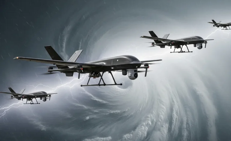
The sUAS platforms, such as the Altius-600 and Blackswift S0, are deployed from the belly of NOAA’s P-3 Orion aircraft before diving into the storm’s core.
Once deployed, these drones utilize advanced AI to navigate the most turbulent regions of the hurricane, seeking out the heat flux that drives storm growth.
The integration also helps address the broader environmental crises facing the nation, including the Georgia heat crisis, by providing a clearer picture of how warming oceans fuel extreme weather.
Redefining Emergency Preparedness
The 2026 season is already being closely watched by global markets as energy prices and logistics remain sensitive to Atlantic disruptions.
NOAA’s new tech-heavy approach provides a much-needed layer of certainty for insurers, shipping lanes, and coastal residents alike.
The agency confirmed that the uncrewed systems will be deployed for every major tropical depression that shows potential for intensification this season.
As the tech matures, NOAA officials envision a future where swarms of hundreds of drones provide a constant, 3D map of every storm in the Atlantic basin.
This is not just an incremental update; it is a total reimagining of how humanity survives the world’s most powerful storms.
Frequently Asked Questions
What are sUAS in hurricane forecasting?
Small uncrewed aircraft systems (sUAS) are autonomous drones equipped with meteorological sensors that fly into areas of a hurricane too dangerous for manned aircraft.
How does this technology improve hurricane forecasts?
By collecting data in the “boundary layer” near the ocean surface, the drones provide precise measurements of wind and heat that determine a storm’s intensity, leading to a 10% increase in forecast accuracy.
Is this technology being used for the first time in 2026?
While testing has occurred in previous years, 2026 marks the first time sUAS data is being fully integrated into NOAA’s official operational forecast models.
Will this reduce the need for manned Hurricane Hunter flights?
No, the drones are complementary. Manned flights are still required to deploy the drones and provide high-altitude data, while the sUAS handle the low-altitude “danger zone.”